Know Your Way Out
Familiarize yourself with major routes out of your neighborhood in case of a evacuation.
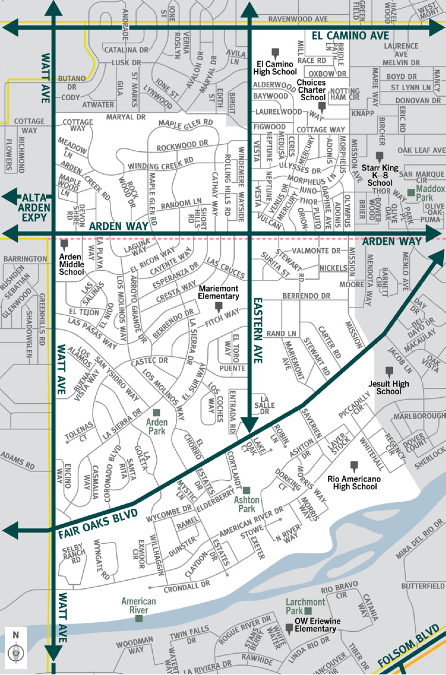

This is a map of Sacramento County evacuation zone number 44, called Southeast Arden Arcade. It is in the central region of the county and is bordered by Watt Avenue to the west, El Camino Avenue and Maryal Drive to the north, Mission Avenue to the east, and the American River to the south. Significant landmarks within this zone are Arden Park, the American River, and Ashton Park. There are no train tracks in this zone. There is a bus route along the west and north borders of the zone. There is a peak-only bus route along Arden Way in the middle of the zone. Major east and west evacuation routes are El Camino Avenue, Arden Way, and fair Oaks Boulevard. North and south evacuation routes are Watt Avenue and Eastern Avenue.
Download a printable Zone 44 map

Need to move livestock to a safer location?
Download a printable Zone 44 livestock evacuation map.
Translated Maps