Know Your Way Out
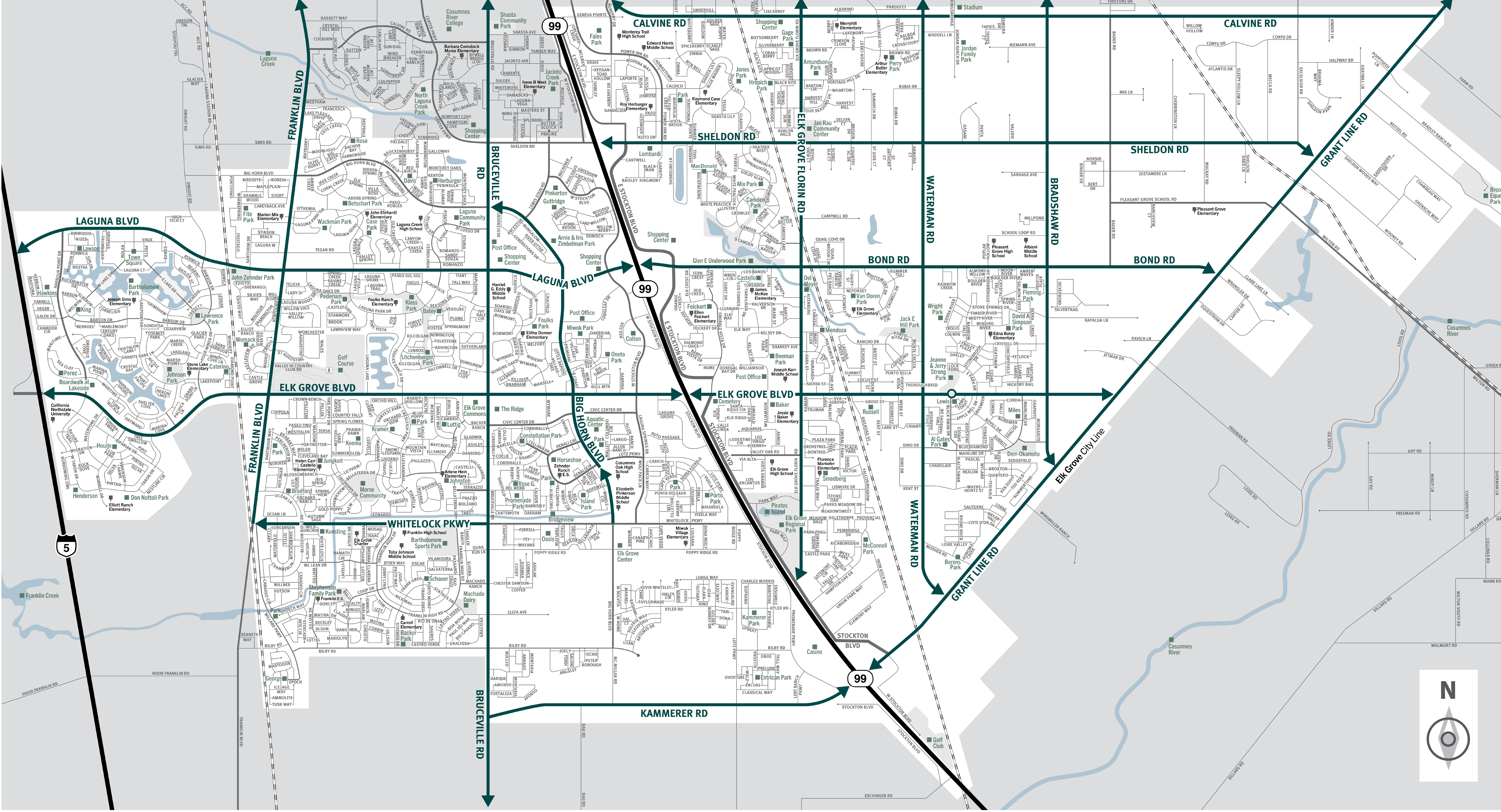
Familiarize yourself with major routes out of your neighborhood in case of a evacuation.


Download a printable City of Elk Grove evacuation map
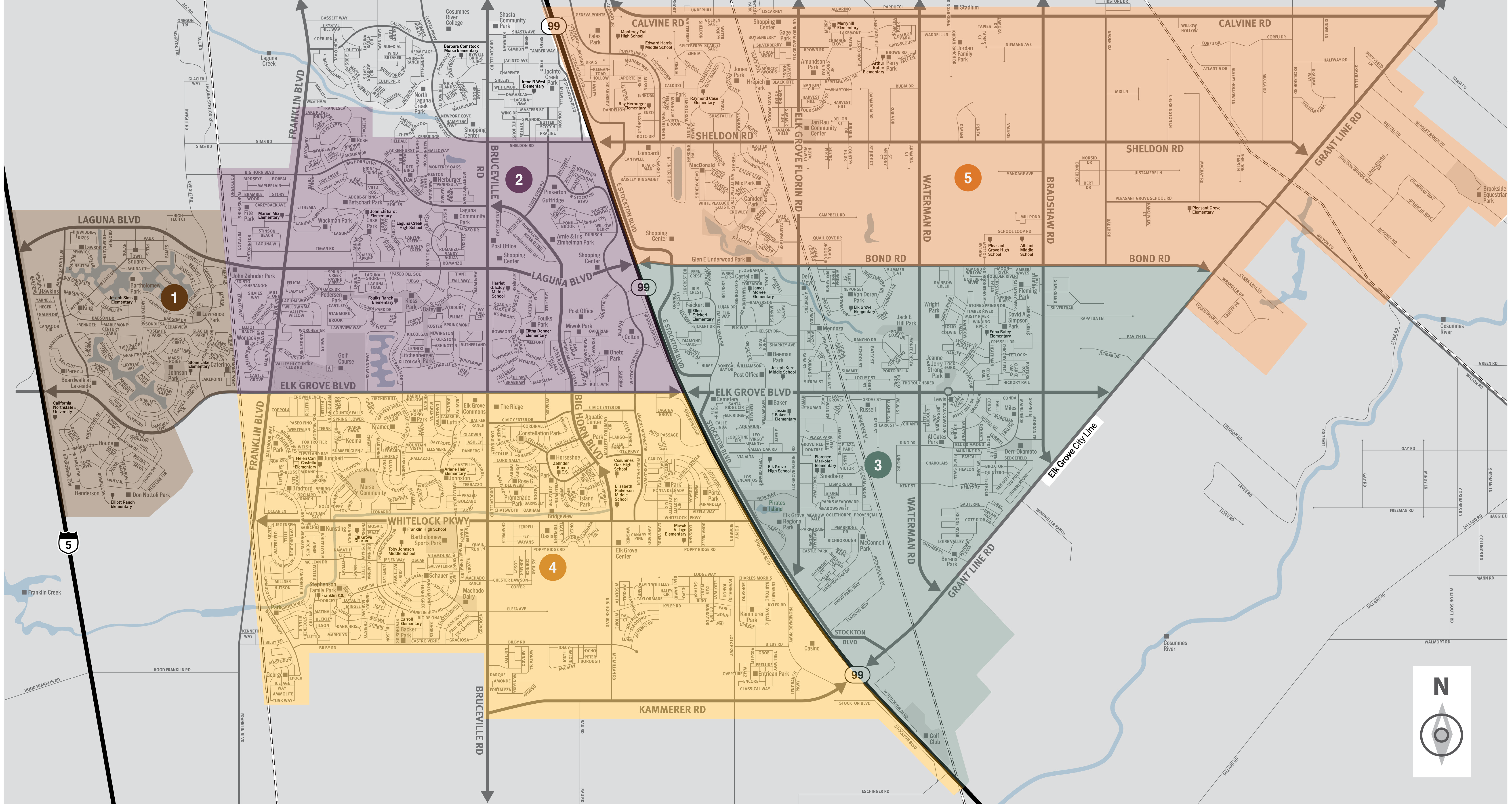
This is a map of the city of Elk Grove located in the central region of Sacramento County. This city contains five zones, which includes the neighborhoods of Laguna Woods, Sheldon North, and Heritage Oaks. Significant landmarks are Boardwalk at Lakeside, Wackman Park, Elk Grove Commons, Stephenson Family Park, Kammerer Park, Oneto Park, Amundson Park, Wright Park, and Al Gates Park. There are train tracks in the eastern, central, and western regions of the city. Major east and west evacuation routes are Calvine Road, Sheldon Road, Bond Road, Laguna Boulevard, Elk Grove Boulevard, Whitelock Parkway, Kammerer Road and Grant Line Road. Major north and south evacuation routes are Interstate 5, Highway 99, Bruceville Road, Franklin Boulevard, Elk Grove Florin Road, Waterman Road, and Bradshaw Road. For additional information specific to Elk Grove please contact the city at (916) 691-2489.
Translated Maps
