Know Your Way Out
Familiarize yourself with major routes out of your neighborhood in case of a evacuation.
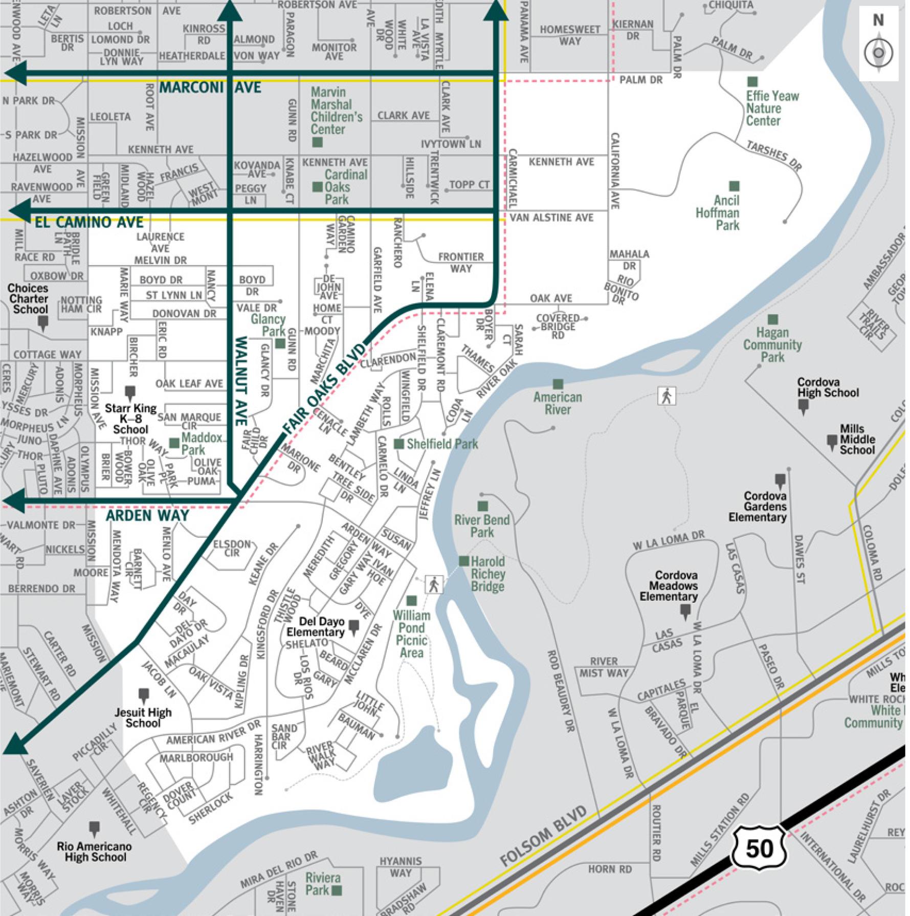

This is a map of Sacramento County evacuation zone number 46, called South Carmichael. It is in the central region of the county and is bordered by Mission Avenue to the west, Palm Drive and El Camino Avenue to the north, and the American River to the east and south. Significant landmarks within this zone are Maddox Park, William Pond Picnic Area, Shelfield Park, Ancil Hoffman Park, Effie Yeaw Nature Center, and the American River. There are no train tracks in this zone. There is one bus route in the northwest area of the zone and a Peak-Only bus route along Arden Way and Fair Oaks Boulevard. Major east and west evacuation routes are El Camino Avenue, Arden Way, and Fair Oaks Boulevard. North and south evacuation routes are Walnut Avenue and Fair Oaks Boulevard.
Download a printable Zone 46 map

Need to move livestock to a safer location?
Download a printable Zone 46 livestock evacuation map.
Translated Maps