Know Your Way Out
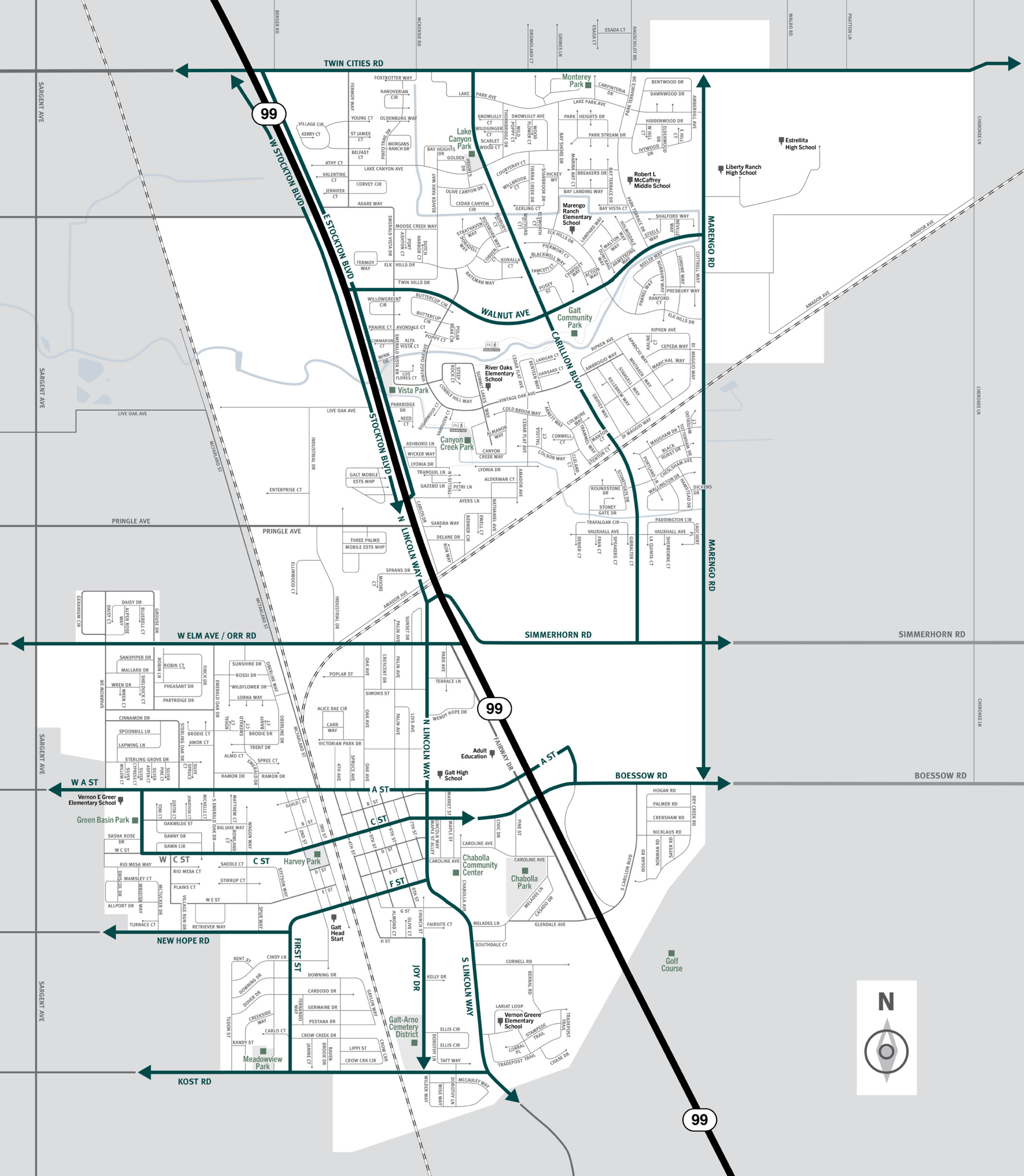
Familiarize yourself with major routes out of your neighborhood in case of a evacuation.


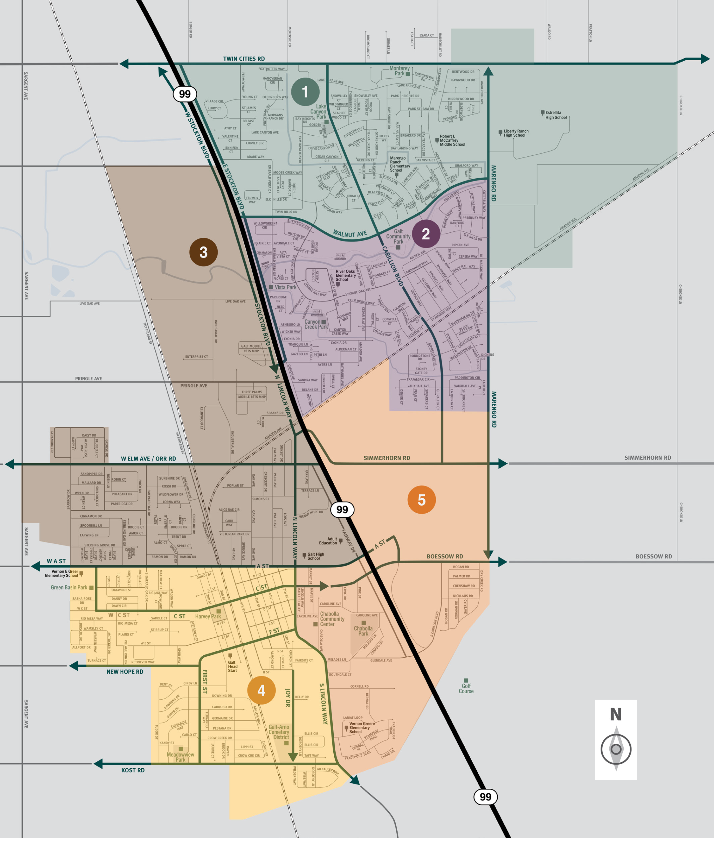
Download a printable City of Galt evacuation zone map
This is a map of the city of Galt located in the southern region of Sacramento County. This city contains five zones, which includes the neighborhoods of Wilder Way, North Galt, and River Oaks. Significant landmarks are Lake Canyon Park, Estrella High School, Canyon Creek Park, Vernon E. Greer Elementary School, and Meadow View Park. Major east and west evacuation routes are Twin Cities Road, Walnut Avenue, West Elm Avenue and Orr Road, Simmerhorn Road, West A Street, New Hope Road, and Kost Road. Major north and south evacuation routes are Highway 99, North Lincoln Way, Marengo Road, and Carillion Boulevard. For additional information specific to Galt please contact the city at (209) 366-7130.
Translated Maps
