Know Your Way Out
Familiarize yourself with major routes out of your neighborhood in case of a evacuation.
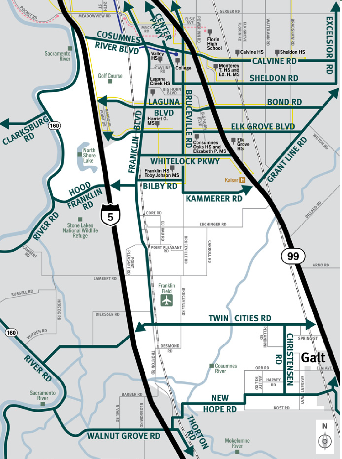
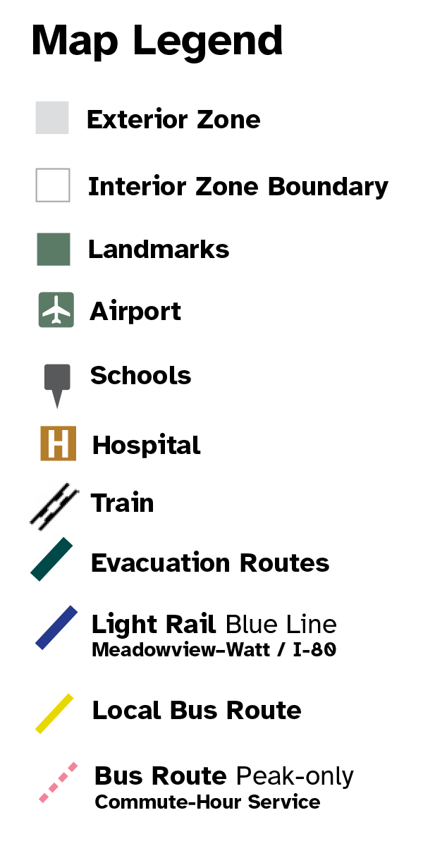
This is a map of Sacramento County evacuation zone number 82, called Freeport, Hood, and Franklin. It is in the south-central region of the county and is bordered by River Road and Interstate 5 to the west, Consumnes River Boulevard to the north, Franklin Boulevard and Highway 99 to the east, and New Hope Road to the south. Significant landmarks within this zone are the golf course, North Shore Lake, and Consumnes River. There are bus and light rail routes in the northern part of this zone. There are train tracks through the center and western portion of this zone. Major east and west evacuation routes are Calvine Road, Hood Franklin Road, Twin Cities Road, Kammerer Road, Laguna Boulevard, and New Hope Road. North and south evacuation routes are Interstate 5, Highway 99, and Franklin Boulevard.
Download a printable Zone 82 map
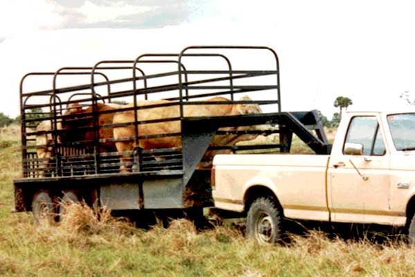
Need to move livestock to a safer location?
Download a printable Zone 82 livestock evacuation map.
Translated Maps