Know Your Way Out
Familiarize yourself with major routes out of your neighborhood in case of a evacuation.
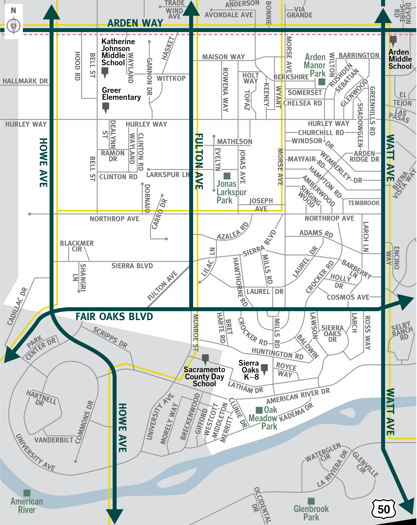

This is a map of Sacramento County evacuation zone number 43, called Southwest Arden Arcade. It is in the central region of the county and is bordered by Howe Avenue to the west, Arden Way to the north, Watt Avenue to the east, and the American River to the south. Significant landmarks within this zone are Arden Manor Park, Jonas Larkspur Park, and Oak Meadow Park. There are no train tracks in this zone. There are bus routes located throughout the zone. Major east and west evacuation routes are Arden Way and Fair Oaks Boulevard. North and south evacuation routes are Howe Avenue, Fulton Avenue, and Watt Avenue.
Download a printable Zone 43 map

Need to move livestock to a safer location?
Download a Zone 43 livestock evacuation map.
Translated Maps