Know Your Way Out
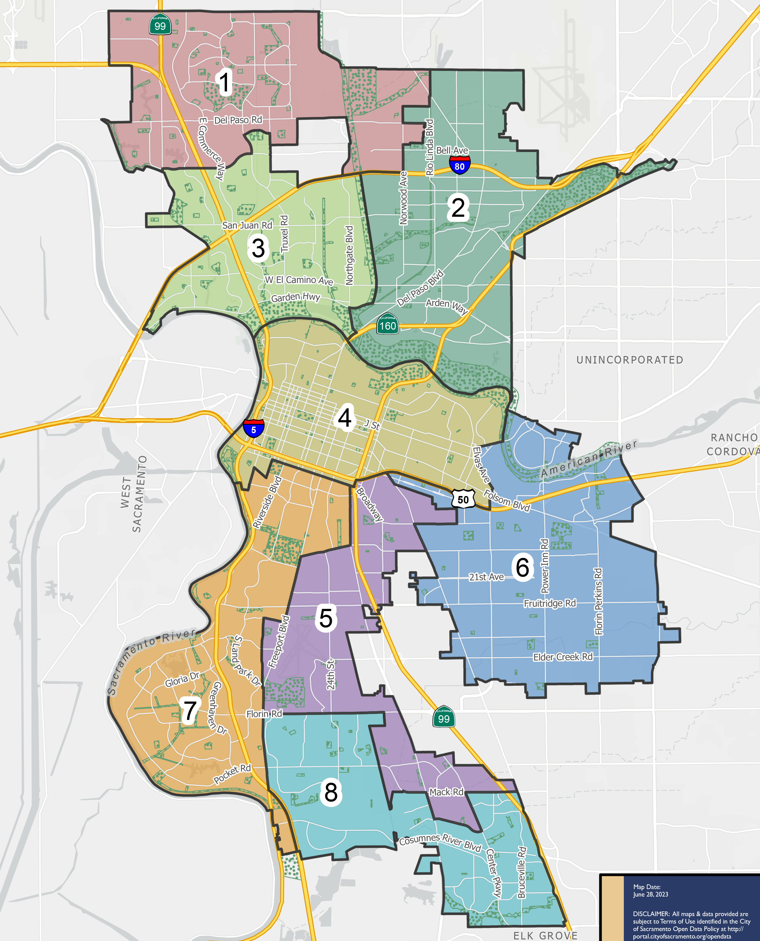
Familiarize yourself with major routes out of your neighborhood in case of a evacuation.

Download a printable City of Sacramento evacuation map
This is a map of the city of Sacramento located in the western region of Sacramento County. This city contains eight zones, which includes the neighborhoods of Land Park, Pocket, North Highlands, and Greenhaven. Significant landmarks are California Exposition Center, Sacramento City College, Sacramento State University, Sacramento Zoo, Sacramento Executive Airport, American River Parkway, Discovery Park, American River, and the Sacramento River. Major east and west evacuation routes are Interstate 80, Highway 50. Major north and south evacuation routes are Interstate 5 and Highway 99. For additional information specific to Sacramento please call the city at (916) 808-7212.
