Know Your Way Out
Familiarize yourself with major routes out of your neighborhood in case of a evacuation.


Download a printable City of Citrus Heights evacuation map
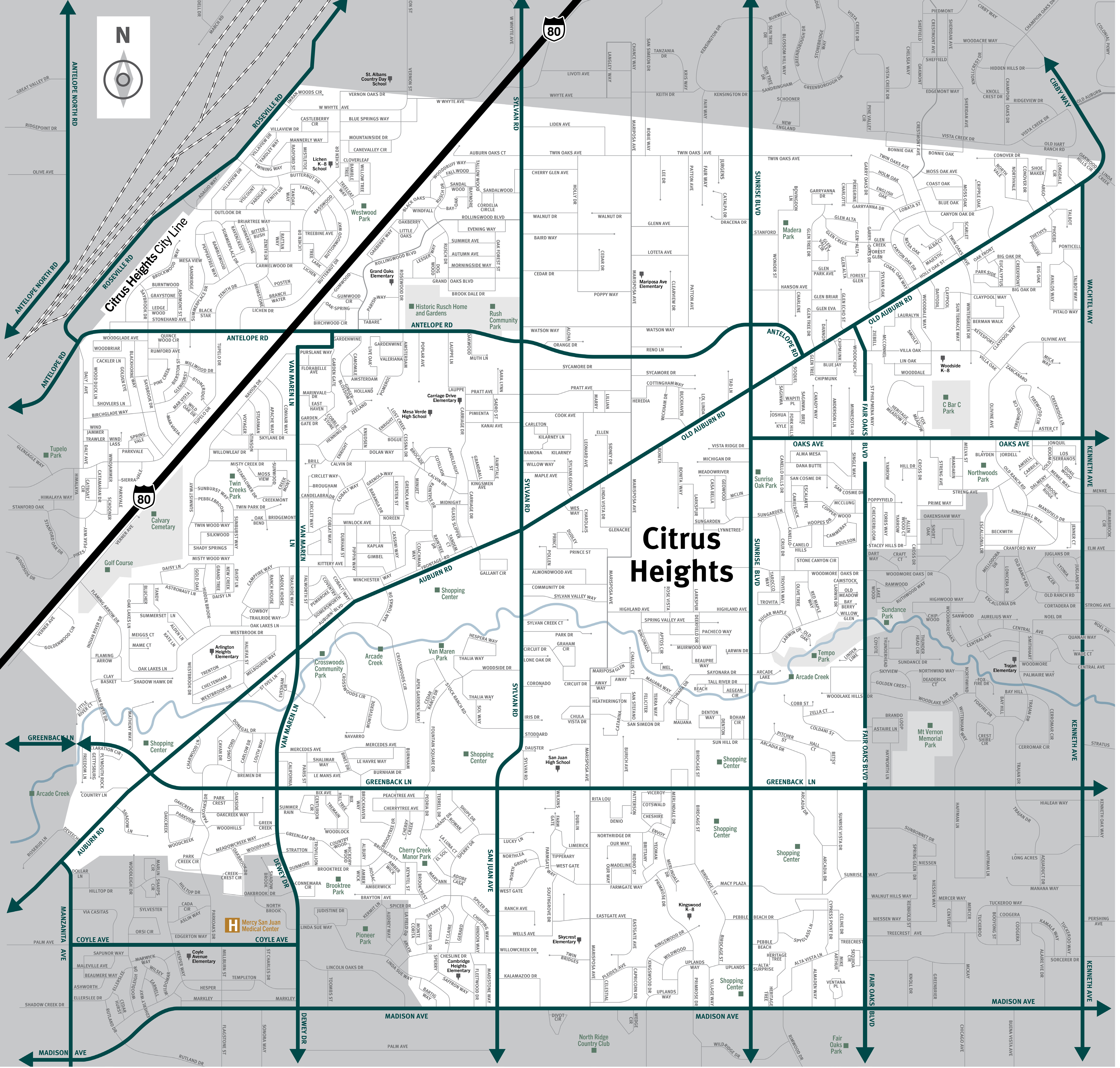
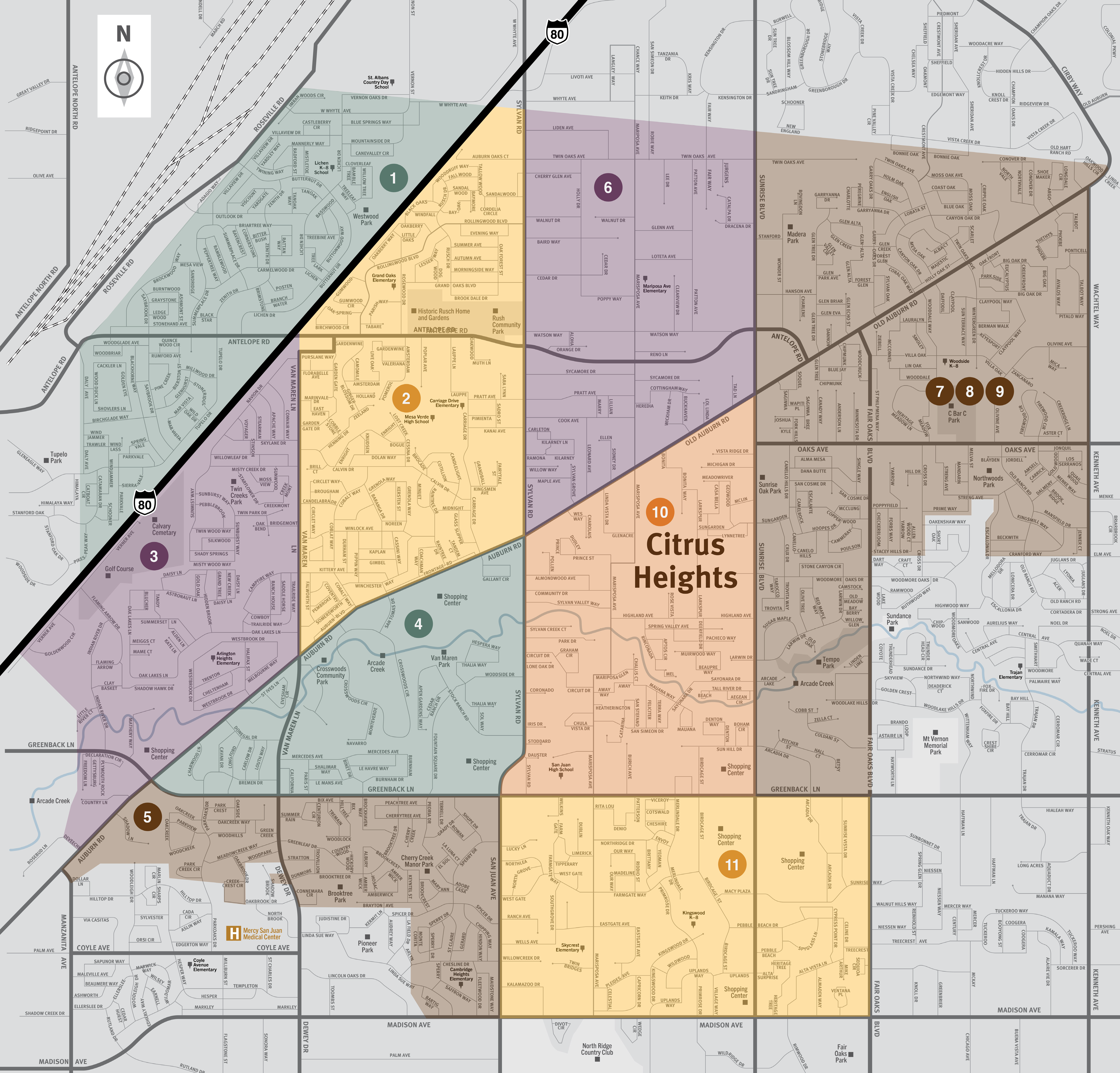
This is a map of the city of Citrus Heights located in the northeast region of Sacramento County. This city contains eleven evacuation zones: Birdcage Heights, Arcade Creek, Northwest, Rusch Park, CHANT, Sunrise Ranch, three zones in CHASEN, SOAR, and Park Oaks. Significant landmarks are the Historic Rusch Home and Gardens, C Bar C Park, Calvary Cemetery, Van Maren Park, San Juan High School, Northwoods Park, Brooktree Park, and Skycrest Elementary School. There are no train tracks. Major east and west evacuation routes are Antelope Road, Oaks Avenue, Old Auburn Road, and Greenback Lane. Major north and south evacuation routes are Van Maren Lane, Sylvan Road, Sunrise Boulevard, Fair Oaks Boulevard, and Kenneth Avenue. For additional information specific to Citrus Heights please contact your city at (916) 725-2448.
Translated Maps