Know Your Way Out
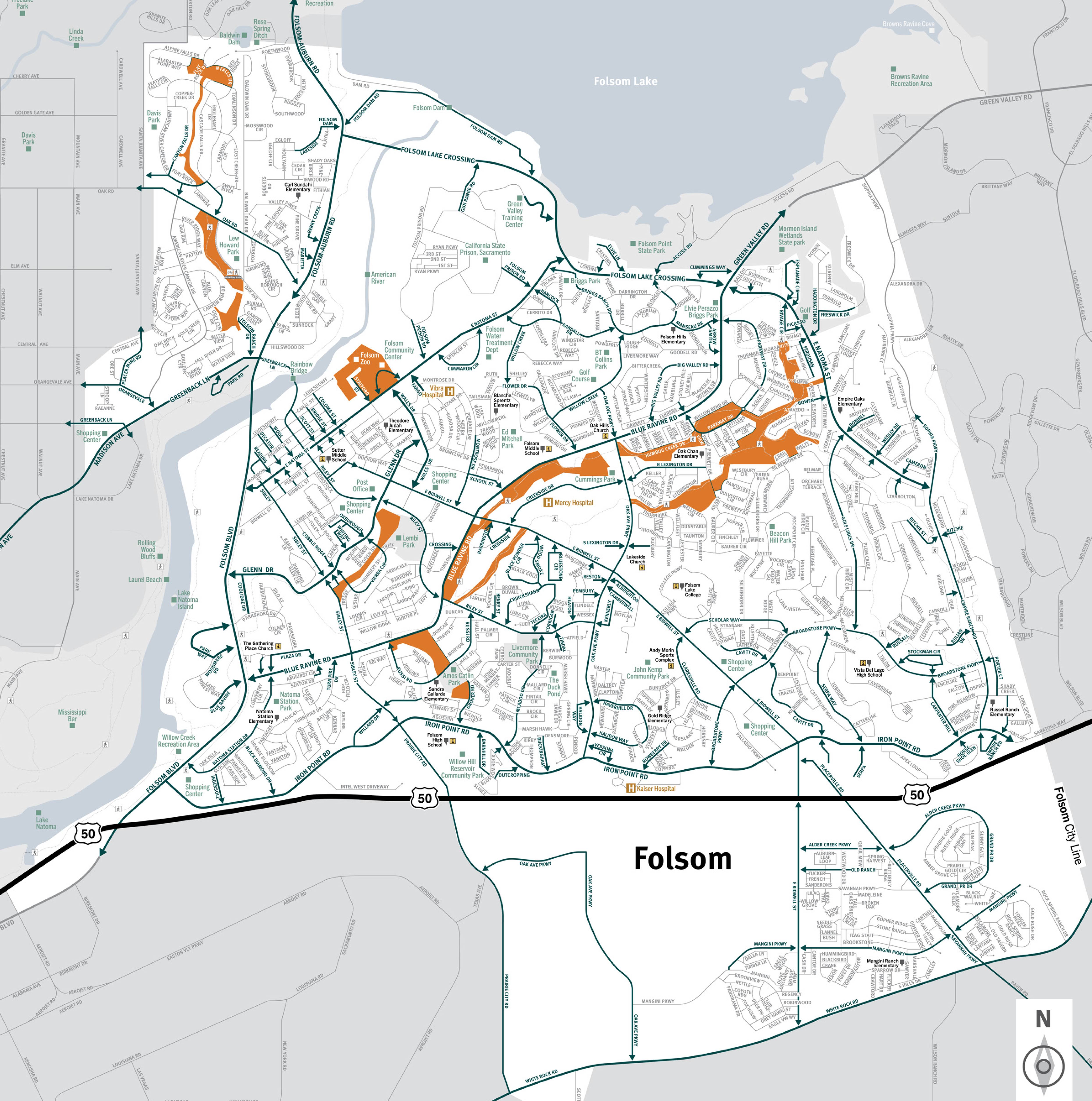
Familiarize yourself with major routes out of your neighborhood in case of a evacuation.


Download a printable City of Folsom evacuation map
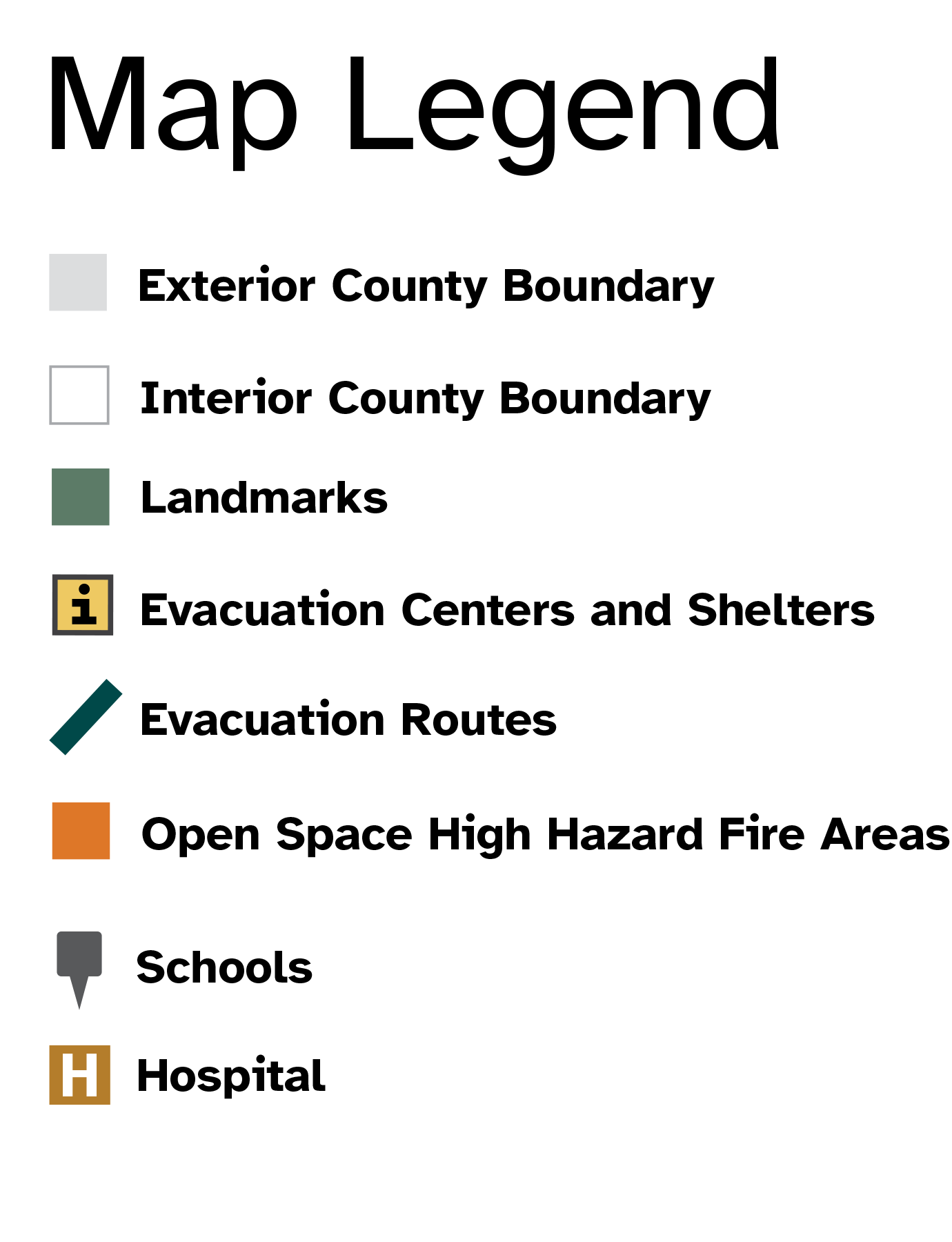
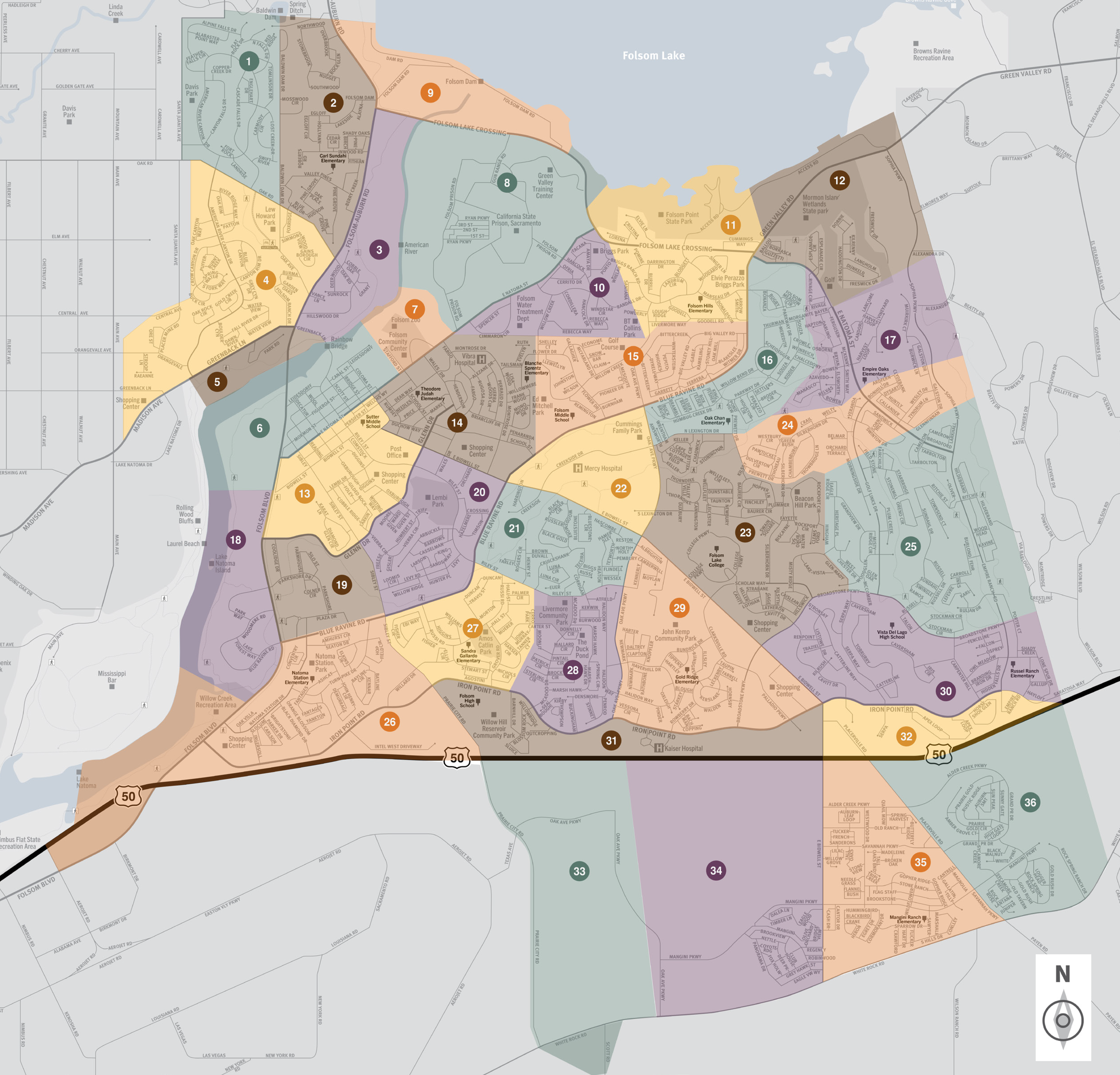
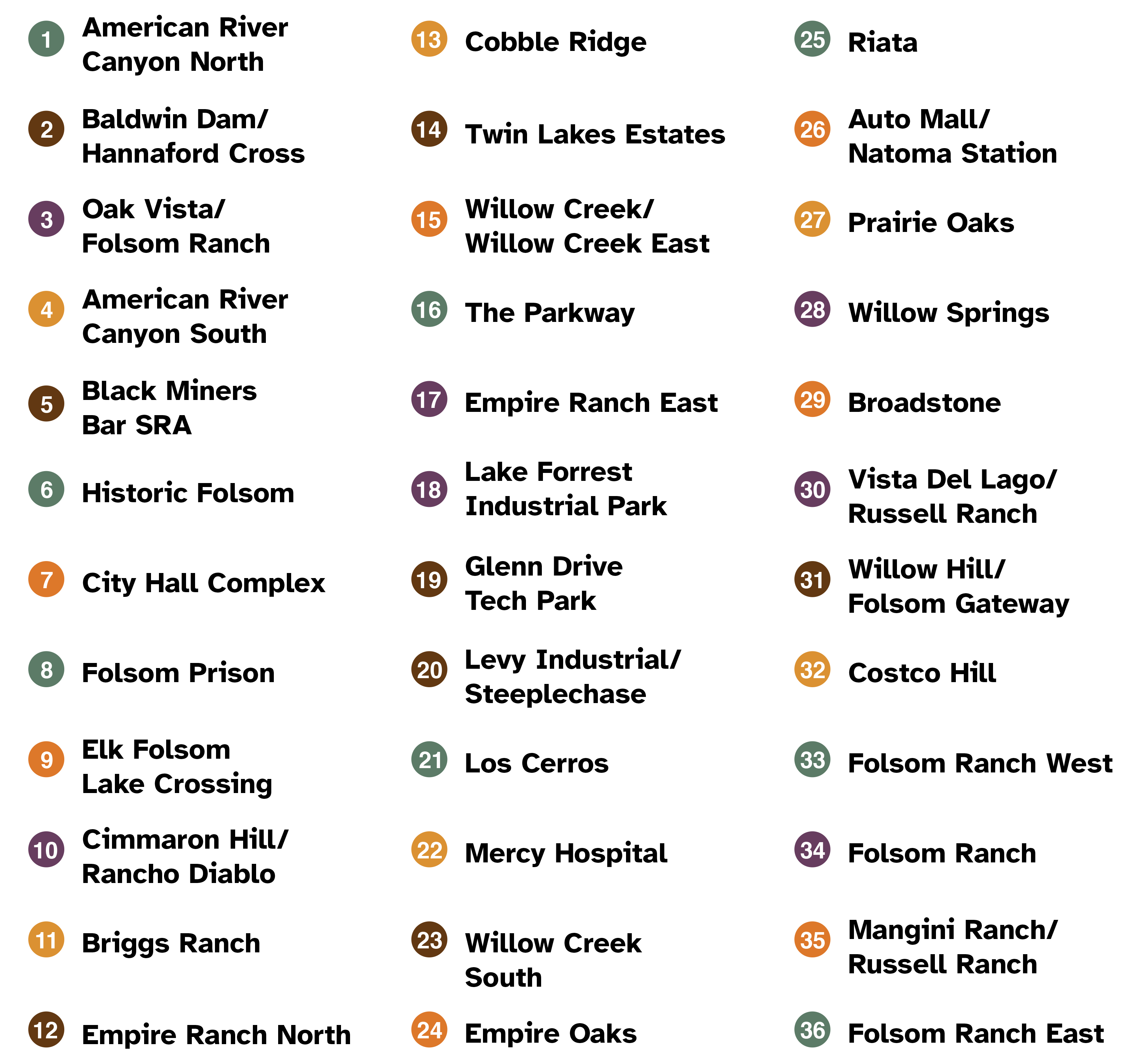
This is a map of the city of Folsom located in the northeastern region of Sacramento County. This city contains thirty-six zones, which includes the neighborhoods of Prairie Oaks, Folsom Ranch, and Cobble Ridge. Significant landmarks are Davis Park, California State Prison, Willow Creek Recreation Area, Folsom Lake College, Vista Del Lago High School, Willow Hill Reservoir Community Park, and Mangini Ranch Elementary School. Major east and west evacuation routes include Highway 50, Madison Avenue, Blue Ravine Road, Folsom Lake Crossing, and East Bidwell Street. Major north and south evacuation routes are Folsom Boulevard, Folsom-Auburn Road, East Bidwell Street, East Natomas Street, and Green Valley Road. For additional information specific to Folsom please contact the city at (916) 355-7200.
Translated Maps
